News Summary
Residents of Kentucky are warned of impending severe weather, including tornadoes and heavy flooding, as forecasts predict storms starting in the afternoon. A tornado watch is in effect for Eastern Kentucky, with significant risks for areas that recently suffered damage. Flood watches have also been issued due to projected heavy rainfall, prompting officials to stress the need for preparedness and safety measures as the storm approaches.
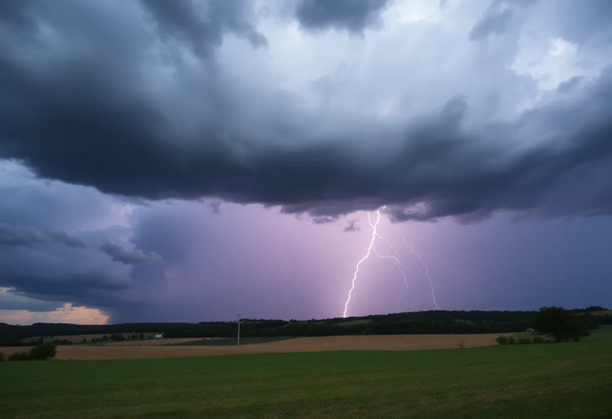
FRANKFORT, Kentucky – Residents across Kentucky are preparing for severe weather as the National Weather Service (NWS) has issued warnings for potential tornado outbreaks and heavy flooding on Tuesday afternoon through the night. The storms are set to hit western Kentucky first, starting around 2 p.m. and are expected to bring damaging winds, hail, torrential rainfall, and even tornadoes.
A tornado watch is currently in effect for all of Eastern Kentucky, which includes Laurel County, until 8 p.m. This warning is particularly concerning for areas that have recently experienced severe storms, as counties like Laurel, Pulaski, and Russell could face heightened risks due to prior structural damage.
Forecasters anticipate multiple waves of storms beginning as early as 11 a.m., with the second wave expected to impact Central Kentucky around 6 p.m., and Eastern Kentucky by 8 p.m. Meteorologist Chris Bailey from the NWS has indicated that many parts of Central and Eastern Kentucky are facing a 15% or greater chance of encountering tornadoes.
In light of the predicted severe weather, a flood watch has been issued for several counties, given the expected heavy rainfall. Previously affected areas may face additional flooding, as the precipitation forecast suggests substantial rain accumulation in a short period.
Residents in the affected areas are advised to stay vigilant by keeping their phones charged and monitoring weather alerts, as weather radios may not function properly during severe conditions. Governor Andy Beshear has emphasized the importance of having a safety plan in place, encouraging preparedness among the public.
Emergency alerts regarding tornadoes and severe thunderstorms are expected to stay active throughout the day on Tuesday, prompting advice for individuals vulnerable to severe weather to pay close attention and adhere to safety recommendations as the storm system closes in.
This severe weather warning comes on the heels of a tragic weekend, which saw at least 19 fatalities across the state due to previous devastating storms. As residents navigate ongoing recovery and repairs, the latest storm system could compound existing challenges.
In summary, the upcoming weather threats include intense storms characterized by high winds, potential tornadoes, and flooding risks aimed at both Central and Eastern regions of Kentucky. Emergency measures and public safety recommendations remain critical priorities as the state braces for what could be another significant weather event.
Deeper Dive: News & Info About This Topic
HERE Resources
Casting Calls on the Rise in Lexington’s Entertainment Scene
Lexington Blue Roofing Company Files for Chapter 11 Bankruptcy
Severe Weather Threatens Kentucky with Tornadoes and Flooding
Lexington Adjusts Trash Pickup Schedule for Juneteenth
University of Kentucky Approves Record-Breaking $8.6 Billion Budget
Melting Pot Considers Return to Lexington Market
University of Kentucky Establishes Strike Teams for Disaster Response
Lexington, KY to Experience Improved Weather Midweek
Cleanup Efforts in Kentucky Following Deadly Tornadoes
Community Leadership and Kindness Flourish in Kentucky
Additional Resources
- Kentucky.com: Severe Weather Update
- Wikipedia: Tornado
- Fox 56 News: Kentucky Weather Today
- Google Search: Kentucky severe weather April 2025
- Herald Online: Weather News
- Google Scholar: Kentucky severe weather reports
- Kentucky.com: Weather Warnings
- Encyclopedia Britannica: Severe Weather
- Fox 56 News: Kentucky Weather Tomorrow
- Google News: Kentucky weather alerts
- WKYT: Jim Caldwell’s Forecast