News Summary
As Memorial Day begins, central and eastern Kentucky is preparing for rain and flash flooding due to an approaching low pressure system. The week kicked off with cool temperatures and gusty winds, but a shift in weather is expected. While temperatures are projected to reach the 70s during the day, rain is anticipated overnight into Tuesday morning with warnings of possible flash flooding. Residents are urged to stay informed about changing weather conditions and take precautions in flood-prone areas.
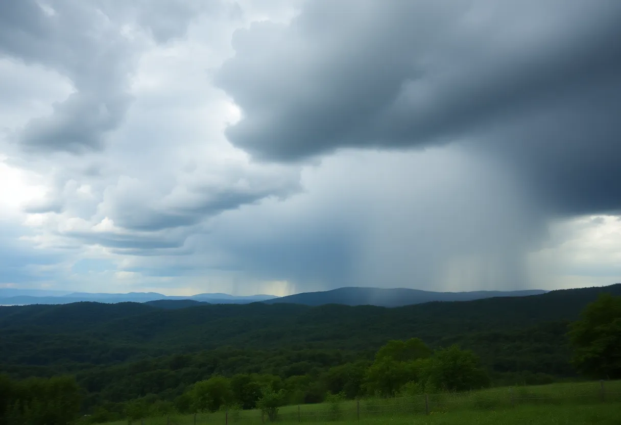
Lexington, Kentucky – Central and eastern Kentucky are bracing for possible rain and flash flooding following a breezy start to Memorial Day. The holiday week has kicked off with seasonably cool temperatures and gusty winds, but the weather is set to change as a low pressure system approaches the region.
On Memorial Day, local weather forecasts predict a blend of sunshine and clouds with afternoon temperatures reaching the low to mid 70s, which is below the average for this time of year. Northeasterly winds will create gusts between 20 to 30 mph, providing a breezy feel throughout the day. While some areas in southern Kentucky may see light showers later in the evening, most regions are expected to remain dry during daylight hours.
The situation will shift as rain is expected to move in overnight into Tuesday morning, driven by the approaching low pressure system from the lower Ohio Valley. As a result, widespread showers and potentially heavy rainfall are anticipated, particularly on Tuesday.
The Weather Prediction Center has issued a Level 2 of 4 “Slight Risk” for flash flooding across much of central and eastern Kentucky. Rainfall totals are projected to vary across the area, with estimates ranging from 1 to 2 inches across the region. However, localized amounts may reach 2 to 3 inches in southern and southeastern Kentucky, raising concerns for localized flooding in low-lying or flood-prone areas.
While rain will dominate the forecast on Tuesday, the risk for severe storms is currently considered low. As the rain tapers off on Wednesday, some scattered showers and storms may linger, while temperatures will again peak in the low 70s under a blanket of cloud cover.
Looking ahead, residents can expect a brief respite from wet weather on Thursday when drier conditions and highs in the low to mid 70s are anticipated. However, another disturbance is forecast to return rain chances on Friday, contributing to the unsettled pattern.
Long-range forecasts suggest that early June may herald a shift to warmer-than-normal weather, with temperatures potentially rising into the 80s as the month progresses. This incoming warmth may offer some relief after a cool start to the holiday week.
As Kentucky prepares for the changing weather and potential hazards, residents are advised to monitor local forecasts and be cautious, especially in areas prone to flooding. Staying informed will be key as the region navigates this dynamic weather pattern over the course of the week.
Deeper Dive: News & Info About This Topic
HERE Resources
Advocates Call for Boating Safety in Kentucky After Tragedy
Lexington, Kentucky Celebrates Memorial Day Weekend with Festivals and Events
Lexington Woman Injured in Hit-and-Run While Rescuing Cat
Kentucky Governor Warns of NOAA Weather Radio Outage
Tornado Watch Issued for Eastern Kentucky Amid Severe Weather
Lexington Emerges as a Climate Haven with Population Surge
Severe Weather Claims 27 Lives in Kentucky and Missouri
Devastating Tornado Hits Kentucky, Leaving Communities in Ruin
Community Rallies to Support Tornado Victims in Kentucky
Riley Gaines to Address Gender Issues at University of Kentucky
Additional Resources
- WKYT: Weather Forecast
- Wikipedia: Lexington, Kentucky
- Fox56 News: Snow Expectations
- Google Search: Lexington Kentucky Weather
- Kentucky Kernel: Severe Weather
- Google Scholar: Kentucky Weather Forecast
- Kentucky.com: Weather News
- Encyclopedia Britannica: Kentucky Weather
- LEX 18: Preparing for Winter Storm
- Google News: Kentucky Weather Alerts