Central Kentucky, October 25, 2025
Central Kentucky is under a Severe Thunderstorm Watch until 8 p.m. EDT, affecting multiple counties. Residents are urged to stay alert as conditions are favorable for severe thunderstorms, which could bring damaging winds, a low-end tornado risk, and large hail. It’s important for the community to stay informed about weather updates and take necessary safety precautions during this time.
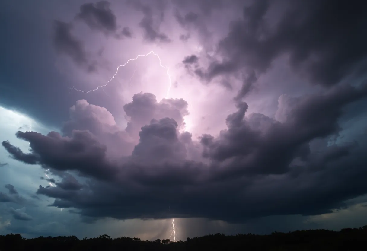
Severe Thunderstorm Watch Issued for Central Kentucky
Central Kentucky is currently under a Severe Thunderstorm Watch until 8 p.m. EDT today. The counties included in this watch are Anderson, Bourbon, Boyle, Casey, Clark, Fayette, Franklin, Garrard, Harrison, Jessamine, Lincoln, Mercer, Nicholas, Scott, and Woodford. The watch indicates potential threats of damaging wind gusts, a low-end tornado risk, and isolated large hail.
Details of the Watch
The National Weather Service issued the watch due to favorable atmospheric conditions for severe thunderstorms. Residents in the affected counties are advised to stay vigilant and monitor local weather updates. A Severe Thunderstorm Watch signifies that conditions are conducive for severe thunderstorms to develop, although no severe weather is currently reported. It is crucial for residents to remain informed and prepared to act if a warning is later issued.
Safety Precautions
During a Severe Thunderstorm Watch, residents should take safety precautions, including:
- Stay Informed: Keep up with local weather updates and listen for any warnings or advisories.
- Secure Outdoor Items: Bring in or secure items outside that could become projectiles in strong winds.
- Prepare for Power Outages: Have flashlights, batteries, and other emergency supplies ready.
- Stay Indoors: Remain indoors during severe weather, avoiding windows and doors.
Understanding Severe Thunderstorm Watches and Warnings
It’s important to understand the difference between a Severe Thunderstorm Watch and a Severe Thunderstorm Warning:
- Severe Thunderstorm Watch: Issued when conditions are favorable for severe thunderstorms. This does not mean severe weather is imminent.
- Severe Thunderstorm Warning: Issued when a severe thunderstorm is currently occurring or expected to occur soon in the warned area. Immediate action should be taken to protect yourself.
By staying informed and prepared, residents can better safeguard themselves during severe weather events.
FAQ
What is a Severe Thunderstorm Watch?
A Severe Thunderstorm Watch is issued when conditions are favorable for severe thunderstorms to develop. It does not mean severe weather is imminent but that it is possible.
What should I do during a Severe Thunderstorm Watch?
During a Severe Thunderstorm Watch, stay informed by monitoring local weather updates, secure outdoor items, prepare for potential power outages, and stay indoors during severe weather.
How can I tell the difference between a Severe Thunderstorm Watch and a Warning?
A Severe Thunderstorm Watch indicates that conditions are favorable for severe thunderstorms to develop, while a Severe Thunderstorm Warning means that a severe thunderstorm is occurring or imminent in the warned area.
Key Features of the Severe Thunderstorm Watch
| Feature | Description |
|---|---|
| Issued For | Anderson, Bourbon, Boyle, Casey, Clark, Fayette, Franklin, Garrard, Harrison, Jessamine, Lincoln, Mercer, Nicholas, Scott, and Woodford counties in central Kentucky. |
| Duration | Until 8 p.m. EDT today. |
| Primary Threats | Damaging wind gusts, low-end tornado risk, and isolated large hail. |
| Issued By | The National Weather Service. |
| Action Required | Stay informed and be prepared to take action if a warning is issued. |
Now Happening on X
- @JoshFarrowWx (October 19, 2025, 2:46 PM): Doppler radar indicates strong thunderstorms moving east at 45 mph, with wind gusts up to 50 mph potentially knocking down tree limbs near Cubage and east of Knoxville, impacting areas close to Lexington. View on X
- @Linknky (October 19, 2025, 1:00 AM): Heavy rains and strong winds up to 40 mph are forecast for the region, urging preparation in northern Kentucky communities near Lexington. View on X
- @PatrickHerionWX (October 19, 2025, 6:11 PM): LEX18 Weather issues Severe Thunderstorm Warning for Clay, Knott, Knox, Leslie, Letcher, Perry, and Whitley counties in Kentucky until 2:45 PM, advising residents to stay weather aware. View on X
- @SkyTrevorBWX (October 19, 2025, 1:58 PM): Severe Thunderstorm Warning from JKL for Bell, Clay, Knox, and Laurel counties in Kentucky until 2:30 PM EDT, with 60 mph winds indicated by radar. View on X
- @BenWKYT (October 19, 2025, 2:01 PM): Severe Thunderstorm Warning for parts of Laurel, Bell, Knox, and Clay counties until 2:30 PM, highlighting hazards of 60 mph wind gusts affecting central Kentucky areas. View on X
- @KBTXKayleigh (October 24, 2025, 11:00 AM): Humidity is rising, potentially leading to showers this afternoon and a powerful overnight system with damaging winds, heavy rain, and isolated tornado risk in the region including Lexington. View on X
- @PatrickHerionWX (October 19, 2025, 1:58 PM): LEX18 Weather reports Severe Thunderstorm Warning for Clay, Knox, and Laurel counties in Kentucky until 2:30 PM, encouraging locals to monitor updates. View on X
Deeper Dive: News & Info About This Topic
HERE Resources
Kentucky Declares State of Emergency as Severe Weather Approaches
Over 30 Million Under Extreme Weather Alerts as Heat Wave Hits Western U.S.
Kentucky Faces Rising Temperatures and Workplace Heat Hazards
Controversies Surround Fayette County Schools’ New Academic Year
Lexington Prepares for Extreme Heat Advisory
Road Closures for New Circle Road Widening Project in Lexington
Severe Weather and Heat Wave Impact U.S. Communities
Major Heat Wave Set to Impact 255 Million Americans
Severe Weather Threatens Kentucky with Tornado Warnings and Flood Risks
Severe Weather Threatens Kentucky with Tornadoes and Flooding