News Summary
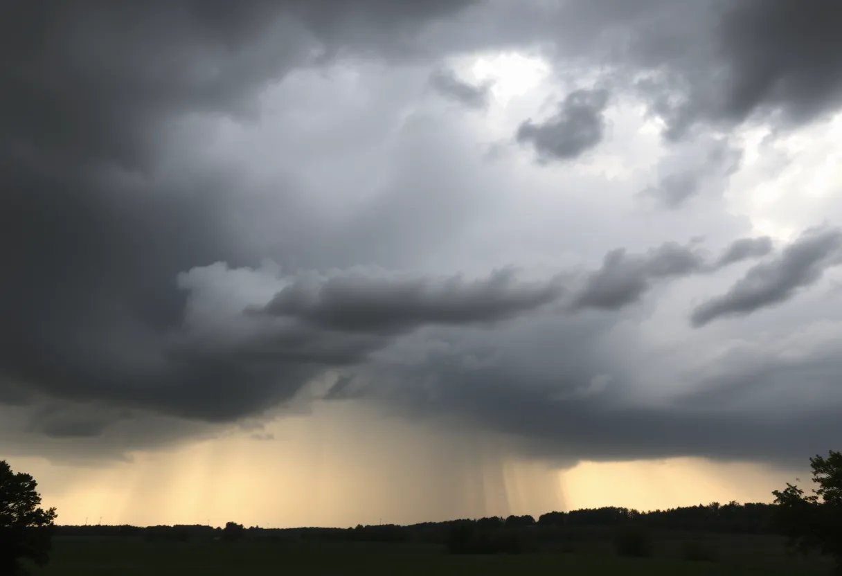
Kentucky is experiencing scattered showers and thunderstorms, raising concerns about potential flooding as temperatures are set to drop significantly. A low-pressure system is bringing increased precipitation, especially in southern and eastern regions. With a 50% chance of rain today and heavy rains expected overnight, residents are advised to remain vigilant. More rainfall is anticipated into next week, creating risks of flash flooding in areas already affected. A freeze warning is also issued for the upcoming days as temperatures are projected to plunge into the mid to upper 20s.
Lexington, Kentucky – Scattered showers and thunderstorms are affecting parts of Kentucky today, prompting concerns of flooding as temperatures are predicted to drop significantly. A low-pressure system is responsible for the increased precipitation, particularly across the southern and eastern regions of the state. Rain is expected to continue into next week, raising flags for flash flooding and localized high water risks.
This morning, a 50% chance of rain was noted, along with mostly cloudy skies. Afternoon temperatures are anticipated to peak at around 86°F, accompanied by light and variable winds. However, conditions are expected to deteriorate into the evening with partly cloudy skies and a 30% chance of additional rain overnight.
By nighttime, temperatures will drop to a low of 72°F, as heavy rains are projected primarily for eastern Kentucky. Areas have already witnessed significant rainfall, creating concerns about rising water levels. The forecast indicates that further rounds of rain and storms will affect the area, with additional rainfall amounts expected between a quarter to half an inch.
The National Weather Service has pointed out that while new rainfall may not greatly impact river flooding levels, the overall situation can still lead to flash flooding concerns in specific zones, particularly where cumulative rain has saturated the ground. Warning signs advise individuals in the affected areas to remain vigilant, especially overnight, when cooler temperatures could also trigger an increased risk of hypothermia for those exposed to high waters.
As temperatures prepare to plunge, a freeze warning has been issued, with lows by Tuesday morning expected to be in the mid to upper 20s. Consequently, residents are urged to seek shelter if they find themselves in flood-prone areas. This drastic temperature dip is set against a backdrop of unsettled weather, with more scattered showers and storms predicted as the week progresses.
Over the weekend, temperatures are forecasted to be considerably cooler, reaching highs of only 57°F on Saturday and 64°F on Sunday. Moreover, rain chances are projected to rise to 60% for Wednesday night, with more showers likely on Thursday, making for an unpredictable forecast ahead.
The possibility of additional rainfall, heavy at times, raises serious concerns about flooding, particularly in areas already saturated from earlier precipitation. Residents are encouraged to remain cautious during stormy weather and to avoid any flooded areas as conditions may change rapidly.
In summary, Kentucky is set to experience an unsettled weather pattern, with ongoing showers and storms contributing to flooding concerns and a significant drop in temperatures. Those living in affected areas should be prepared for sudden weather changes and take appropriate precautions throughout the week.
Deeper Dive: News & Info About This Topic
HERE Resources
Major Roadwork Scheduled in Lexington’s Downtown Area
Remembering Bill Enright: A Pillar of Lexington’s Irish Community
Blue Grass Airport Introduces New Security Screening Policy
Central and Eastern Kentucky Prepare for Heat and Flooding Risks
Lane Closures Planned on West High Street in Lexington
Lexington’s Cholera Epidemic: A Historical Reflection
Lexington No Kings Rally Encourages Reflection on Independence
Body of Missing Kentucky Physician Found in Alaska
Kentucky Communities Prepare for Fourth of July Celebrations
Retail Hours for Fourth of July in Lexington, KY
Additional Resources
- WKYT: Weekend Forecast with Scattered Showers
- Wikipedia: Weather Forecasting
- Kentucky.com: Weather News Article
- Google Search: Kentucky Weather Forecast
- WTVQ: Showers and Storms Update
- Google Scholar: Kentucky Weather
- WLWT: Building Fire in Covington
- Encyclopedia Britannica: Weather
- WKYT: Rain Showers Forecast
- Google News: Severe Weather Kentucky